"TREKKING IN NEPAL"
Nepal is the ultimate destination for trekkers from all over the world. This bustle is so admired that one in every five visitors to this country comes solely for the purpose of trekking. Nepal is not a large country in terms of geographical area, yet huge contrasts in altitudes and climates as you move from south to north support an amazing mix of lifestyles, flora and fauna. Although it is Nepal's scenic beauty that lures the multitude of visitors, people of different cultures that you come across on the way are what make the experience quite memorable.
You can go trekking at any time of the year through the popular seasons are spring (February-May) and autumn (September-November). Winter is very cold above 4000 M because of snow on the high mountain passes. So keep yourself at lower altitudes. During the Monsoon season (June-August), you can trek in the rain shadow areas north of the Himalayas like Mustang, Manang and Dolpa where the rain clouds cannot reach them. The best part about trekking in this season is that the routes are less crowded, and the meadows are green and in full blossom.
Most admired trekking areas in Nepal
1. Everest Region:
The Everest region is located in the northeast of Nepal. The 10-day walk through the middle hills of Solu to the higher altitudes of Khumbu to the base of Sagarmatha (Mt. Everest), the world's highest peak, is an opportunity to observe and participate in the daily life
of the legendary Sherpa people. The prime attraction 8848 M peak lies in Sagarmatha National Park, which is also home to two other Eight Thousanders Lhotse (8516 M) and Cho-Oyu (8201 M), besides several other prominent peaks above 6000 M.
Designated as a World Heritage Site in 1979, much of the 1148km2park lies above 3000 M. The park is composed of rugged terrain with deep gorges, glaciers and huge rocks. The vegetation in the park varies from temperate plants like pine, hemlock, fir, juniper, birch, rhododendron and shrubs to alpine plants and then to bare rock and snow. It is home to the ghoral, tahr, serow and musk deer as well as the impeyan pheasant, blood pheasant, red-billed chough and the yellow-billed chough.
The trail to Everest begins at Lukla, the airport at 2850 M. The trail climbs up the Dudhkoshi River Valley, and the following day brings you to the legendary Sherpa village Namche Bazaar in the Khumbu (3450 M), which is the starting point for expeditions to Everest and other peaks in the area. Above Namche lie the traditional villages of Khunde and Khumjung, the largest villages in the Khumbu at the foot of the sacred peak Khumbila.
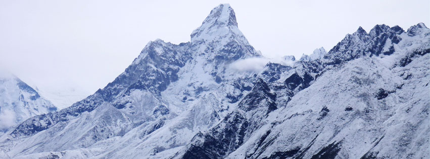
Across the canyon from Khunde, perched on a high ridge, is the Tengboche Monastery, the leading Buddhist centre in the Khumbu. The monastery rests amid stunning views of Everest, Lhotse and Ama Dablam.
From Tengboche, you can continue on to Pheriche, Kala Paththar and the hamlet of Gorakshep. From there, Everest Base Camp is easily accessible, as is the summit of Kala Paththar (5545 M), from which much of Mt. Everest is clearly visible. However, you must take time to properly acclimatize as the altitude gains are rapid.
Best season: October-November, March-May, December-February
Getting there: Everest region can be reached by air or on foot. Drive for Jiri from Kathmandu a 10-hour drive from where it is a two-day walk to Lukla. By air, fly to Lukla a 30-minute flight which is served by many airlines from Kathmandu.
Accommodation: Resorts, hotels, lodges, tea houses and camping sites
Permits and fees: Entry permits are necessary before starting the trek and should be taken in Kathmandu.
2. Annapurna Region:
The Annapurna Region in North Western Nepal has been touted as having the world's best trekking routes. From the lake city of Pokhara, popular treks lead to Jomsom, Annapurna Base Camp, Mustang, Manang and around the Annapurna mountain. Short treks to Sikles and Ghandruk are just as popular. The Annapurna Region is an area of contrasts comprising the wettest, driest and windiest places in Nepal.
The Annapurna Circuit is by far the most popular and requires a minimum of about three weeks to go around the Annapurna massif. What makes this trek so special is that you can look up to something new in scenery every day. The Annapurna Conservation Area begins at 790 M and reaches a high of 8091 M, the summit of Mount Annapurna I, the world's 10th tallest peak. The area encompasses forested Middle Mountain, high Himalaya and trans-Himalayan desert plateau similar to the landscape in Tibet as you move north. The lower elevations are dotted by Gurung, Magar, Thakali and Brahmin-Chhetri villages while Tibetan cultural influence becomes apparent as you go north.
The trek goes counter-clockwise from Besi Sahar, off the Pokhara-Kathmandu Highway, to Naya Pool, and reaches its high point at Thorong La, a pass at 5416 M. On the way, you pass through stunning mountain scenery, Manaslu, Langtang Himal, Annapurna I-II-III-IV and Dhaulagiri. In between these two 8000 M peaks lies the dramatic Kali Gandaki gorge the deepest in the world.
The trek in the eastern part follows the Marsyangdi River upstream till Manang, which is a string of seven villages that form the upper arc of the Annapurna Circuit Trekking Trail. The area is composed of stark, rocky terrain dotted with turquoise lakes, including Lake Tilicho (4919 M), the world's highest lake.
The trek also passes through Muktinath (3749 M), a site holy for both Buddhists and Hindus before descending to Poon Hill at the end of the trek. Poon Hill provides spectacular views of Annapurna I and Dhaulagiri as well as South Annapurna and Machhapuchhre.
Best season: March-May, September-November. Unlike other parts of Nepal, even the monsoon months (June-Aug) are ideal to visit upper Mustang that falls in the rain shadow area. Most trekking routes in the Annapurna Region are well serviced by teahouses.
Getting there: Pokhara, the resort city 200 km west of Kathmandu, is the departure point to treks in the Annapurna region in the western Himalaya. There is an airport in Jomsom if you are going to Mustang and an airport at Chame for access to Manang.
Accommodation: Resorts, hotels, lodges, teahouses and camping
Permits and fees: Entry permits are necessary and should be taken in Kathmandu or Pokhara, before starting the trek.
3. Langtang Valley and Gosaikunda Lake:
Langtang lies about 130 km north of the Kathmandu Valley close to the border with Tibet, China. Lt is Nepal's first national park, and lies between the Himalayan range to the north, dominated by Langtang Lirung (7,245 m), the highest peak in the area, and smaller peaks to the south Chimse Danda (ridge), Ganja La pass (5,122 m), Jugal Himal and Dorje Lakpa (6,989 m).
The trek here is more adventurous as the area is visited by fewer tourists. Apart from the spectacular scenery, a visit to the area is an opportunity to explore the lifestyle and culture of the Tamangs, whose craftsmanship, language, dress and houses bear their uniqueness. Langtang is also known for its many glaciers of which there are more than 70 of varying sizes and high altitude lakes. The forests in the region have temperate and sub-alpine vegetation. Wildlife includes migratory birds, deer, monkeys, thar and pika.
Apart from Langtang, treks can be arranged to the holy Gosaikunda Lake at 4,380 m, which covers much of the Langtang National Park, and Helambu. Gosaikunda is said to have been created by Lord Shiva when He thrust His Trident into a mountain to draw water to cool his at after swallowing poison.
Best seasons: March-May, October-November.
Getting there: From Dhunche, which is 117 km by road from Kathmandu.
Accommodation: Lodges and camping
Permits and fees: Entry permits should be obtained in Kathmandu before starting the trek. To reach Helambu from Kathmandu, a permit to pass through the Shivapuri National Park is required. It can be obtained at the entry of the Shivapuri National Park near Budhanilkantha.
4. Manaslu and Tsum Valley:
To the east of the Annapurna Range lies the Manaslu range. Few visitors visit this area, which makes a trek to this unspoiled place all the more unique. The area is bordered by the Budhi Gandaki River to the east and by the Marshyangdi River to the west.
Manaslu is the eighth highest mountain in the world at 8,163 m. The mountain's long ridges and valley glaciers offer feasible approaches from all directions, and culminate in a peak that towers steeply above its surrounding landscape, and is a dominant feature when viewed from afar. The Nepalese Government only permitted trekking of this circuit in 1991 with Restricted Area Permit and that trekkers travel in a group of two with a registered guide. In route, 10 peaks over 6,500 meters are visible, including a few over 7,000 meters. The highest point reached along the trek route is theLarkya Laat an elevation of 5,106 meters.
Tsum Valley Trek -an offbeat trekking in the foothill of Manaslu & Ganesh that caters the unexplored landscapes and authentic Tibetan culture in the monasteries dotted in remote highland villages. Tsum Valley was a restricted area until it was opened for trekking in 2008. The Tsum Valley is a sacred Himalayan pilgrimage valley. Literally “Tsum” means vivid, this serene Himalayan valley is rich in ancient art, culture and religion. The Tsum Valley has the long history of Buddhism.
Since the treks in the Manaslu region originate at around 1000 m and reach as high as 5200 m, a trekker will come across a wide range of flora typical of the mid-hills and alpine regions of Nepal. Vegetation found here is the pine and rhododendron, while wildlife includes the barking deer, pika and Himalayan marmots. Some of the birds found here are the pheasant, raven and chough. The region has Tibetan cultural influences. Government regulations require al groups trekking in the Manaslu Circuit to be fully sufficient.
Best season: March-May, September-November
Getting there: From Soti Khola in Gorkha, which is 140 km from Kathmandu
Accommodation: Resort hotels, lodges, tea houses and camping
Permits and fees: The Manaslu Circuit requires a permit and can be obtained at Bhrikutimandap, Kathmandu.


