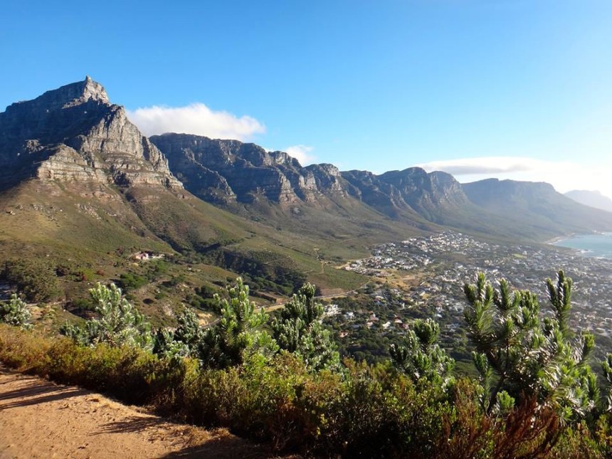
For years, the famous flat-topped mountain (1084m) named "Hoeriekwagga" (Mountain in the Sea) by the Khoi Khoi bushmen, forming Cape Town city's backdrop has enjoyed unparalleled status as South Africa's top tourist attraction.
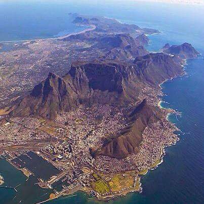
The mountain now one of the 7 Natural Wonders of the World and a UNESCO World Heritage Site, situated in the worlds' richest Floral Kingdom, attracts more than 2,5 million visitors per year, 2nd only to the world famous V&A Waterfront. With Devil's Peak (1000 m) on the right & Lions' Head (670 m) on the left, coming in from the airport to this place is easy.
Stone Age man was the first to populate the mountain slopes due to artifacts discovered in Kirstenbosch Botanical Gardens. Then came the Khoi & the San. From the sea, the mountain range can be spotted from as far away as 200 km (125 miles), was named by Antonia de Saldanha in 1503 as the "Table of the Cape of Good Hope" and he was also the "first" European man to climb the mountain in search of fresh water. In 1797, the first woman to climb TM was Lady Anne Barnard.
Around 560 million years ago when the earth was one land mass and started separating to form the various continents, the foundation of Table Mountain, known as the Malmesbury Group was laid under the now vanished Adamastor Ocean. 20 million years later an intrusion of molten granite erupted to the surface creating the foundation for most of the mountain ranges in the Cape Peninsula.
When the two types of rock met along a line under the Northern end of the mountain, thermal metamorphism took place. This freak of nature can be clearly viewed at the Sea Point Contact Site that was first discovered by Clarke Able in 1818 & visited by Charles Darwin in 1836 on his world expedition Known as "The Journey of Discovery".
Around 500 m of riverine & estuarine sediments to a depth of 1700 m were laid down as far as the eye can see from the top of TM known as the Graafwater Formation on top of the Cape Granite. Above the Graafwater Formation, about 650 m of thick-bedded quartz sandstone was deposited known as the Peninsula Formation. The final layer was known as the Pakhuis Formation and 35 m of Tillite was left behind by the Ordovician Ice Ag while 400mya, is found on top of the mountain. Remnants of this formation can be seen around Maclear's Beacon (1086 m) even today. On top of these, not visible today were another four formations due to erosion, the 1st being of laminated, fossiliferous claystone and the top three layers of quartz sandstone.
Later, 130 million years ago, when the Super-continent, Gondwana finally separated, the mountain pushed up out of the ocean. Erosion isolated Table Mountain
from the Hottentots-Holland Mountains to the east to form the "Cape Flats", a few million later and left what we see today.
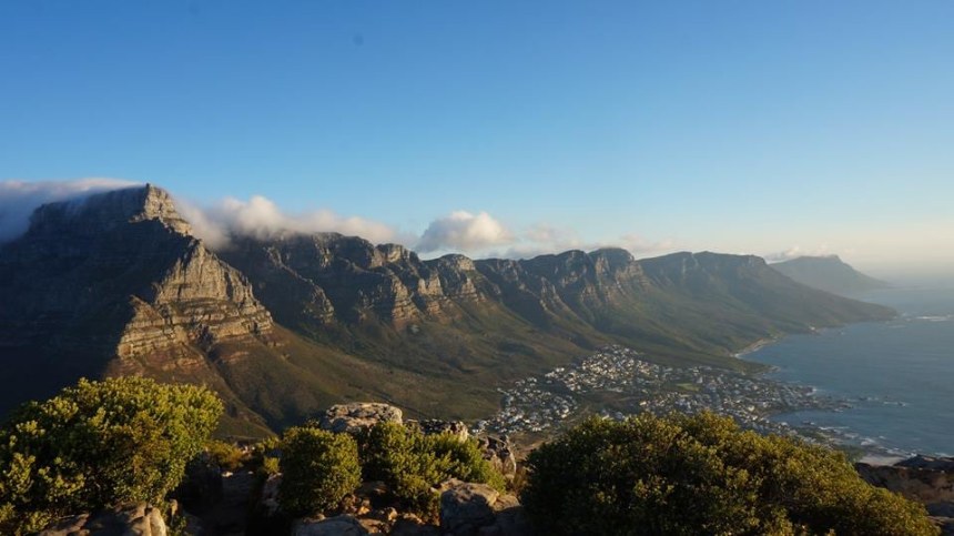
The Table is around 2 km long and 300 m wide. The highest point is Maclear's Beacon. The Table is divided into the Western Table, Central Table & Eastern Table. South the table drops by 300 m to the Back Table, two ridges jut out from this section. To the right looking south, is the Twelve Apostles previously known as the Gable Mountains by the Dutch. The Twelve Apostles overlook Camp's Bay on the Atlantic Ocean side.
The mountain range extends from Signal Hill in the north to Cape Point in the South.
In 1580 Sir Francis Drake passed by and named it the "Fairest Cape in the World".
During the peak season, the mountain is lit up at night giving it an eerie mystical appearance. On special occasions, the mountain is lit up in different colors depending on what "day" is being celebrated.
Many legends abound as to the existence of the mountain the most famous derived from Greek origin.
During the rule of giants on the earth, their leader Adamastor led a rebellion against the Greek gods, after years and many battles they finally lost the fight and Adamastor as the rebellious leader was exiled to the south, he lies chained at the Cape as the mountain turned to rock and whenever a storm rages it is said that Adamastor is venting his rage for being imprisoned here.
Other interesting facts:
1798 The first horse ride up the mountain.
1889 the first accident occurred on Fountain Ravine and a rescue party was needed.
1891 the Mountain Club of SA (MCSA) was established with 8 Cape Malay guides as they were the most experienced climbers.
1894, 5 hiking routes was mapped, 10 year later 50 more & today we have over 800 routes.
1829 James Holman was the first blind man to ride a horse up the mountain.
1937 Sidney James at 72 cycled from Constantia Nek to the top.
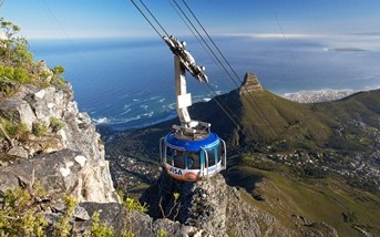
1929 the first Cable Car started operating.
1928 A.P. Cartwright drove a Baby Austin to the top in 4 hours
1947 marked the first illumination of TM during the visit of the British Royals.
The fastest ascent of Platteklip Gorge to the top was done in 27 minutes and 11 minutes descent.
Mid 1980’s saw the first Paragliders launch from the top.
1998 Base jumpers, Karl Hayden & Shaun Smith did the first jump of TM
2009 a high line walk was performed over Union Ravine.
Bungee jumpers have jumped from the Cable Car
2014, A.J. Calitz ran up the mountain 14.5 times in 12 hours to set a world record.


